Mine Explo Company Limited
Nyankuru-Nyangoto PML1856MAR Google Earth Investor Summary
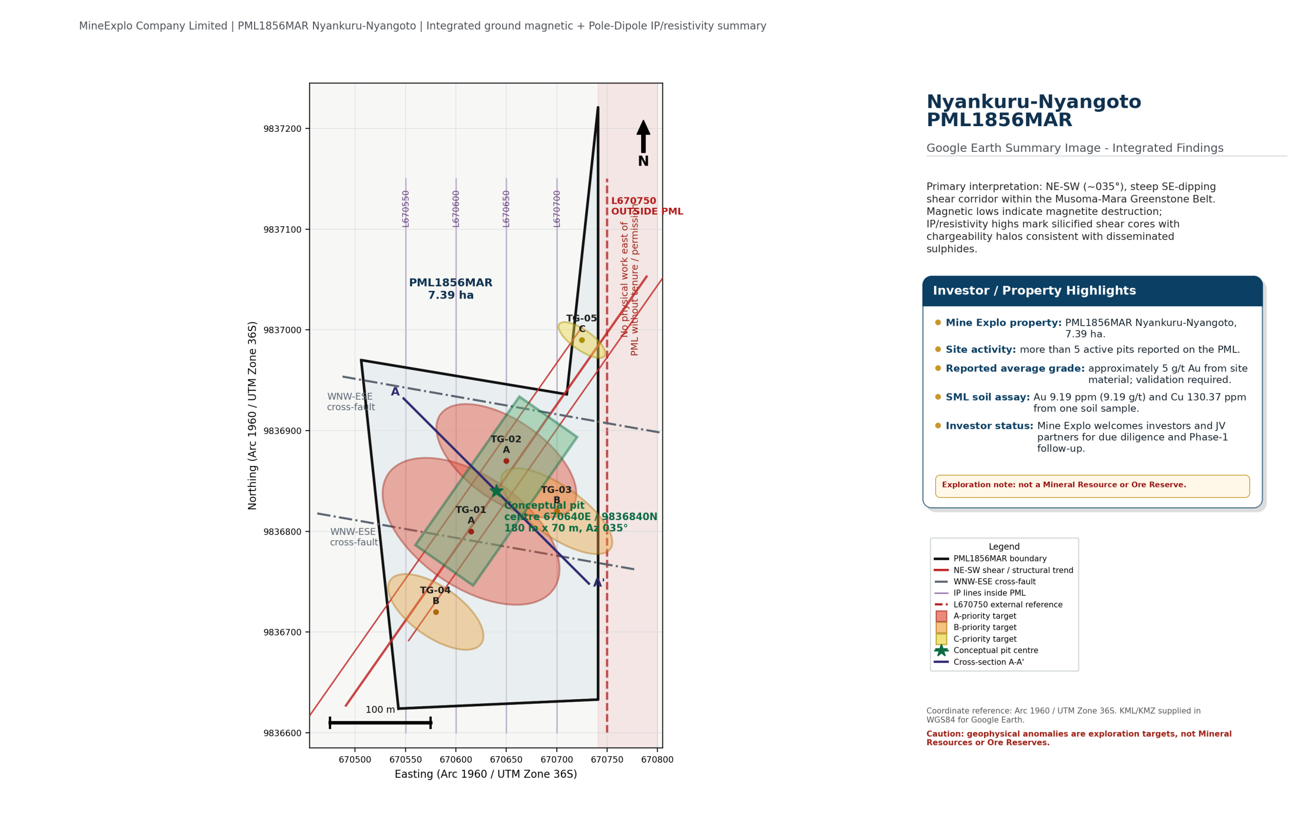
PML1856MAR is a Mine Explo gold property at Nyankuru-Nyangoto, Mara Region, Tanzania. This page provides the Google Earth KMZ, integrated target summary, active-pit/site information, indicative grade information and investor discussion note.
7.39 haPML1856MAR licence area.
>5 active pitsReported active pits/workings on site; DGPS survey required.
~5 g/t AuReported average grade from site material; systematic validation required.
Google Earth layers included
- PML1856MAR boundary and licence context.
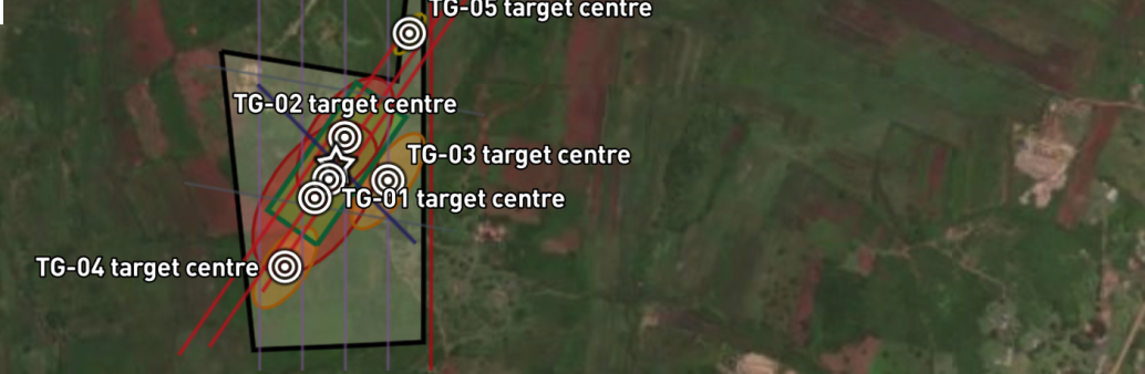
- TG-01 to TG-05 target footprints and target-centre markers.
- TG-01/TG-02 conceptual starter-pit envelope and pit centre.
- IP survey lines L670550 to L670700 inside the PML.
- Line 670750 / Line 5 as outside-PML geological-continuity reference only.
- Interpreted NE-SW shear corridor, WNW-ESE cross-faults and cross-section A-A'.
- Investor/site note layer including active-pit statement and SML assay certificate image.
SML assay highlight
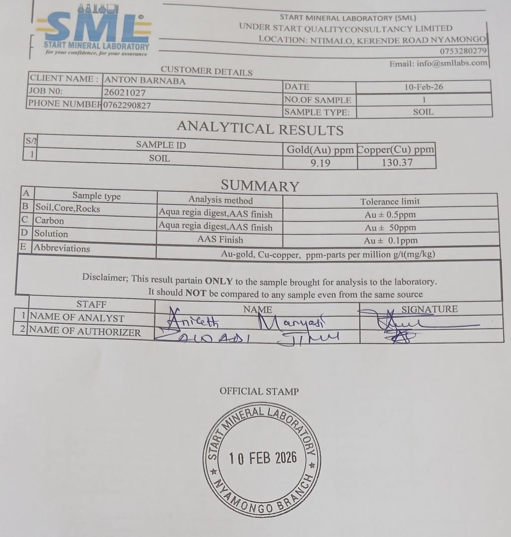
The attached certificate image reports Gold (Au) 9.19 ppm and Copper (Cu) 130.37 ppm from one soil sample. For solid samples, ppm is numerically equivalent to g/t. This is a sample result, not a resource grade.
Investor note: Mine Explo welcomes investors for further discussion on technical due diligence, Phase-1 exploration, trenching, test-pitting, scout drilling, possible development work and tenure-protection options.
Exploration caution: geophysical targets, active pit observations, reported average grade and single-sample assay results do not constitute a Mineral Resource or Ore Reserve. Any investment or mining decision should be based on systematic sampling, independent assays, drilling, metallurgical test work, geotechnical review, environmental/social review and regulatory compliance.
Website upload note: keep this HTML file, the KMZ, the KML and the two image files in the same website folder so the buttons and images resolve correctly.